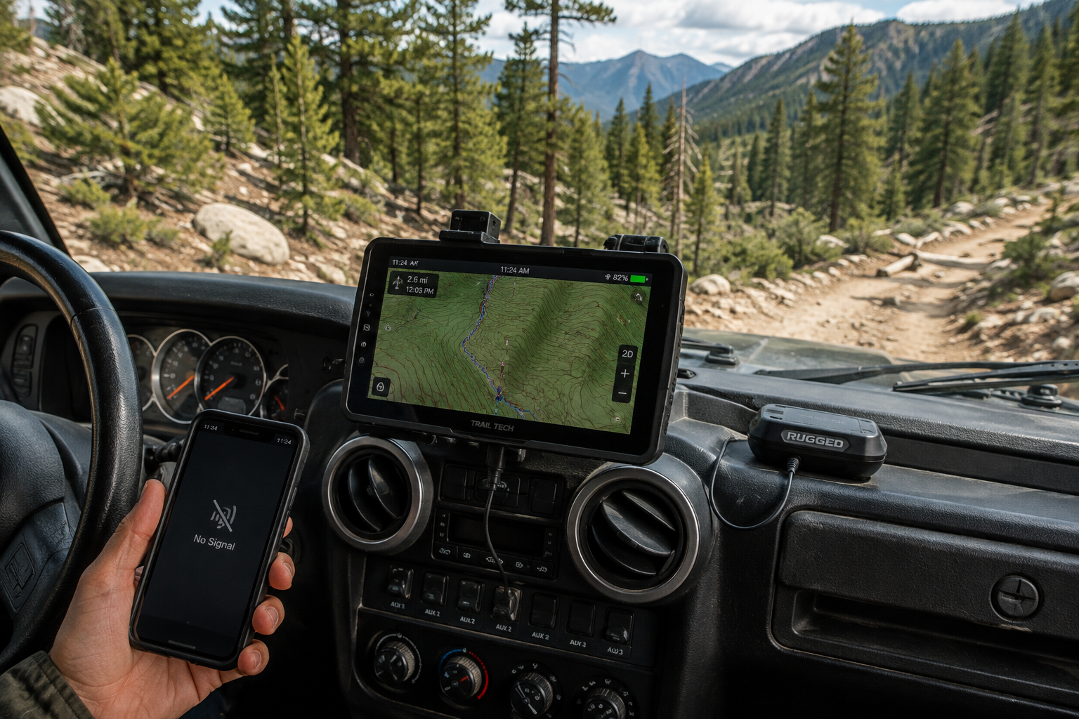
Cell service ends almost exactly where the interesting trails begin, which means the navigation plan can't depend on a live signal at the moment it's needed most. The gap between "the map app worked fine on the drive out" and "the map app has been spinning for twenty minutes" is usually the last bar of signal disappearing behind a ridge — and by then it's too late to plan around. GPS itself works everywhere, on every trail, with zero signal — it's the map data layered on top of that GPS position that fails without preparation, and that distinction is the whole subject of this guide.
A Live Map Is a Convenience, Not a Plan
Most phone map apps quietly assume a data connection to fetch tiles, reroute, or even show your position accurately once you're off the cached area. That works fine right up until the truck rounds a bend with no signal, at which point the app either freezes on a blank grid or shows a last-known position that's already miles behind current.
None of that is a defect in the app — it's just not built for the job of getting a truck back out of terrain with zero connectivity, which is a different requirement than daily commuting navigation. Standard road-mapping GPS also has no idea a given dirt track exists in the first place; it's built around paved roads and highways, not the unmarked spurs and fire roads that make up most real trail networks. This gap catches people off guard precisely because the same phone works flawlessly for the entire drive to the trailhead — there's no obvious warning sign that the tool is about to stop being useful the moment pavement ends.
FIG. 01 — DOWNLOADED TOPO DATA, NO SIGNAL REQUIRED
What Actually Makes a Navigation Tool "Off-Grid Ready"
Not every mapping app or device handles the no-signal case the same way, and the difference usually only shows up once it's too late to do anything about it. A tool that looks capable in a parking lot with full bars can fall apart the moment it's actually asked to work without a connection.
Before trusting one on a real trip, confirm it actually covers the basics:
True offline storage — the map tiles are saved to the device before you leave cell range, not cached opportunistically as you drive.
Topographic layers — elevation lines and terrain shape matter far more off-road than a flat road map, especially where there's no marked trail to follow.
Trail-specific data — actual off-road trail networks, land ownership boundaries, and legal access status, not just paved roads with the trail overlaid as an afterthought.
Waypoints and points of interest — campsites, water sources, and known hazards marked in advance, since you can't search for them once you're offline.
Multi-constellation GPS — devices that use GPS alongside GLONASS and Galileo satellite systems hold a more reliable position fix in canyons and dense tree cover, where GPS alone can struggle.
Checking for these five things before a trip, rather than after a bad experience on the trail, is the difference between a tool that's genuinely off-grid ready and one that just has "offline" in its marketing copy.
Download the Map Before the Signal Disappears
Offline map downloads solve most of the problem for free or cheap, as long as they're pulled down before leaving cell range — not attempted from the trailhead once the last bar is already gone. Downloading a wider area than the planned route covers the case where a wrong turn or a washed-out section pushes the truck outside the intended path.
Broadly, off-grid navigation tools fall into two categories, and most serious builds eventually use both rather than picking one:
Phone or tablet apps with offline maps — the cheapest entry point, and genuinely enough for most day trips. The tradeoff is battery life, since the phone is also running everything else that day — camera, comms, music — and a dead phone is a dead map.
Dedicated GPS units — built for exactly this job: longer battery life, a screen readable in direct sunlight, and topo data that doesn't compete with anything else for power. The extra cost buys reliability on longer or more remote trips where a phone alone is a single point of failure.
Most people start with the phone-app category since it's already in their pocket, and add a dedicated unit later once their trips get remote or long enough that a single point of failure stops being an acceptable risk.
Dedicated GPS Units Earn Their Keep on Longer Trips
A phone with offline maps covers most day trips, but a dedicated GPS unit adds real battery life, a screen readable in direct sun, and topo data that doesn't compete with the phone's battery for photos, comms, or anything else running that day. For remote multi-day routes, that reliability difference stops being a nice-to-have and starts being the thing standing between "found the way back" and "guessing."
The other advantage that's easy to overlook is durability. Dedicated units are built to survive the same dust, vibration, and temperature swings the truck itself deals with, mounted permanently rather than propped in a cupholder or clipped to a vent — a phone dropped in a mud puddle at a stream crossing is a genuine trip-ending event in a way a ruggedized, hard-mounted GPS unit generally isn't. That physical resilience matters more the farther a trip gets from any kind of backup plan.
Checking a route's difficulty rating ahead of time also flags how remote a trail actually runs — a useful signal for deciding whether a phone's offline maps are enough or a dedicated unit is worth the extra cost.
A map that only works with signal isn't backup — it's the same plan as having no map at all, once the bars disappear.
A Pre-Trip Navigation Checklist Worth Actually Using
Most navigation failures on the trail trace back to a step skipped the night before, not a device that failed in the field. The fix isn't better technology — it's a habit that gets run every single time, even on a trail that's been driven a dozen times before.
Before pulling out of cell range, run through this every time:
Download offline maps for the route, plus a margin well beyond the planned path — not just the exact line you expect to drive.
Confirm the topo layer is actually downloaded, not just the standard road layer — check by switching to airplane mode and scrolling around before you leave.
Check the trail's difficulty rating and recent condition reports so the plan matches what the trail is actually doing right now, not a stale rating from last season.
Fully charge every device, and bring a battery pack or in-vehicle charging as backup — the plan fails the moment the only navigation device on board goes dark.
Tell someone off the trip your planned route and expected return time, independent of any electronics on board.
Set a mental or written turnaround trigger — a time of day, a fuel level, or a specific obstacle — before you're standing in front of the decision under pressure.
None of these six steps take more than a few minutes, and together they cover the handful of ways a navigation plan actually falls apart on the trail — which is exactly why skipping even one of them tends to be the step that mattered.
A Satellite Communicator Is the Backup, Not the Primary
Satellite messengers and communicators exist to call for help or check in when nothing else works, not to replace a real navigation plan. Two-way satellite messengers let you send and receive texts and trigger an SOS with a real response; simpler locator beacons only broadcast a distress signal with no confirmation anyone received it. Either is worth carrying on remote trips specifically because they solve a different problem than maps do — getting a message out, not getting the truck back on route.
Treating a satellite device as the navigation plan itself is the same mistake as trusting a live map with no offline backup: both fail exactly when conditions get hard enough to need them.
Build the Kit for the Trip, Not the Gadget
Downloaded offline maps handle most trips on their own. A dedicated GPS unit earns its cost on longer or more remote routes. A satellite communicator rides along as the backup for when something genuinely goes wrong, not as the primary plan. Layered that way, no single failure — a dead phone, a lost signal, a wrong turn — ends the trip on its own. Even the best navigation setup is only half the plan; the recovery kit in the truck is what actually gets you moving again if the trail itself is the problem, not the map.
The Mistakes That Actually Strand People
Almost every "we got lost and it turned dangerous" story on the trail traces back to one of a small number of repeatable mistakes, not to genuinely unpredictable circumstances. The most common is assuming the phone's regular map app will "probably still work" once cell service ends, without ever testing that assumption in airplane mode before leaving pavement. The second is downloading only the exact route and nothing around it — the moment a washout or a locked gate forces a detour, the offline coverage runs out exactly when it's needed most.
The third mistake is treating a single device as the whole plan. A phone that gets dropped in a creek crossing, a GPS unit that dies from a dead battery, or a satellite communicator that never gets turned on until it's too late — any one of these is recoverable if it's not the only tool in the truck. It only becomes a real problem when the backup plan was "I'll figure it out" rather than an actual second device or a genuine offline map loaded somewhere else. None of these mistakes require bad luck to cause a real problem — they just require skipping a five-minute check the night before.
What Off-Grid Navigation Actually Costs
Budget for off-grid navigation splits cleanly into three tiers, and it's worth being honest about which one actually matches how remote your trips get rather than buying for a fantasy expedition that isn't on the calendar. The free tier — a phone with a free offline-capable mapping app — genuinely covers casual day trips on trails that are well within cell range on either end, even if the middle stretch drops out. The mid tier adds a paid subscription to a more capable off-road mapping app, unlocking better trail-specific data, land ownership layers, and more reliable offline downloads; this is where most regular weekend off-roaders land, and it's a reasonable middle ground between cost and capability.
The top tier — a dedicated GPS unit plus a satellite communicator — is the right call specifically for remote, multi-day, or solo trips where a failure genuinely can't be shrugged off and driven around. It's also the tier people over-buy into for trips that never actually leave well-traveled, well-covered trails close to town. Matching the spend to the actual remoteness of the trips being planned, rather than to what feels appropriately serious, keeps the budget honest and avoids gear collecting dust in a drawer.
There's also a middle path worth considering before jumping straight to the top tier: a mid-tier subscription app paired with a basic, no-frills satellite locator beacon covers a surprising amount of ground for solo or small-group trips into moderately remote terrain, without the full cost of a dedicated GPS unit. It's not the ideal setup for genuinely multi-day expedition travel, but for the trip that's a step beyond casual weekend wheeling without being a full backcountry expedition, it closes most of the real gap at a fraction of the top-tier price.
The Bottom Line
Off-grid navigation isn't really a gear problem — it's a preparation habit that happens to require some gear. The truck that never gets stuck without a way back isn't the one with the most expensive GPS unit bolted to the dash; it's the one whose driver downloaded the right maps the night before, checked that the topo layer was actually there, and had a genuine backup plan for the moment the primary device failed. A phone with properly downloaded offline maps beats a dedicated GPS unit that never got its maps updated before the trip, every single time.
Match the tool to how remote the trip actually is, run the pre-trip checklist without skipping steps because the trail feels familiar, and treat a satellite communicator as insurance rather than a substitute for a real map. Done that way, the technology stops being the thing standing between a good trip and a bad one — the preparation is.